

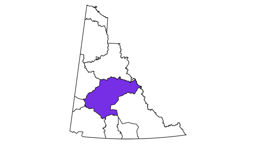
A First Nation in the Yukon and the territorial government have signed an agreement that will see the two parties work together to help create a land use plan for around seven per cent of the territory. The proposed planning region’s boundaries cover 35,000 square kilometres and fall entirely within the territory of First Nation of Na-Cho Nyäk Dun (FNNND). The region is home to wildlife like moose, caribou and sheep, and also includes wetlands and watersheds like the Tsé Tagé (Beaver River). “The First Nation of Na-Cho Nyäk Dun looks forward to a land use planning process that is rooted in the knowledge, laws and values of the Na-Cho Nyäk Dun in the spirit of reciprocity and sustainability for all who inhabit the Na-Cho Nyäk Dun Traditional Territory now and forever,” said Chief Dawna Hope in a statement on July 31. A land use plan is a shared blueprint for how land and resources in a specific area should be used and protected, such as areas where mining, hunting, tourism, conservation or development occurs. Land use planning aims to reflect the rights of First Nations, while also balancing social and economic priorities, helping reduce or avoid conflicts between competing interests. A government press release said current activities in the planning region include mineral exploration and development, forestry, agriculture, tourism and other economic endeavors. The plan builds on work already begun under the Tsé Tagé land use planning process, which was at the centre of a court case in 2023 after the government appealed a court decision halting a mining exploration project from proceeding in the Tsé Tagé watershed. Hope described land use planning as more than a procedural step. “It is a reaffirmation of our role as stewards of our lands and waters and of our place as a self-governing First Nation,” she said. Hope said in a separate statement that in the meantime, any new staking in the area while land use planning is underway would not only be unwelcome, but illegal. She said her First Nation has its own mining policy in place for its traditional territory as the planning process moves forward. The MOU marks the start of the fourth land use planning process in the territory. Regional land use plans are already in place for the Peel Watershed and North Yukon. A plan for the Dawson region is at the final recommendation stage. Land use planning is grounded in Chapter 11 of the Umbrella Final Agreement, which outlines how federal, territorial and First Nation governments can work together on regional land use planning in the territory. FNNND is one of 11 self-governing First Nations in the territory. Continue Reading
Na-Cho Nyäk Dun and Yukon sign agreement for land use plan

Leave a Comment


