

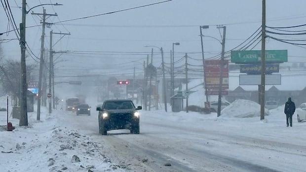
PEIPrince Edward Islanders should prepare for poor driving conditions Wednesday morning as the first significant snowfall of the season hits the province overnight, says CBC meteorologist Tina Simpkin.Queens and Kings counties likely to see highest amounts, Environment Canada saysThinh Nguyen · CBC News · Posted: Dec 02, 2025 12:14 PM EST | Last Updated: 2 hours agoListen to this articleEstimated 2 minutesThe audio version of this article is generated by text-to-speech, a technology based on artificial intelligence.Environment Canada says P.E.I.’s first significant snowfall of the season will start late Tuesday afternoon and continue until Wednesday afternoon. (Thinh Nguyen/CBC)Prince Edward Islanders should prepare for poor driving conditions Wednesday morning as the first significant snowfall of the season hits the province overnight, says CBC meteorologist Tina Simpkin.A special weather statement from Environment Canada remains in effect for all three counties, warning of snowfall and strong winds from late Tuesday afternoon until Wednesday afternoon.The agency is forecasting 10 to 15 centimetres of snow, possibly more, with the highest amounts likely in Queens and Kings counties. Coastal areas may see a mix of snow and rain. Northeasterly wind gusts could reach 80 km/h.Simpkin said the combination of strong winds and snowfall could make travel difficult.“That’s going to reduce our visibilities to almost nothing on the roadways overnight tonight and into the early morning hours tomorrow morning,” Simpkin told CBC’s Island Morning on Tuesday.She added that coastal areas will see mostly rain, while snow will taper off inland from west to east by Wednesday afternoon.Environment Canada says strong winds and heavy, wet snow could break tree branches and damage utility lines. The agency is advising Islanders to adjust their travel plans to avoid hazardous conditions.With files from Island Morning
1st significant snowfall of season to bring poor road conditions to P.E.I. on Wednesday


