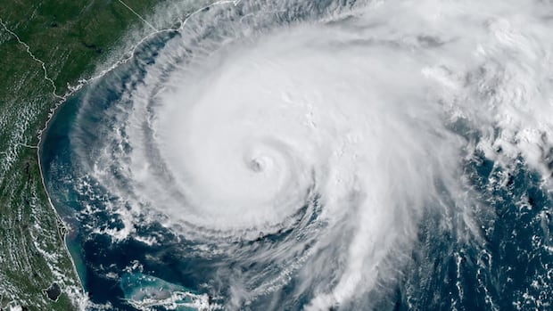
Nova ScotiaCBC meteorologist Ryan Snoddon has a look at what the second half of the season might bring.A quiet start to the season does not necessarily mean a quiet finishRyan Snoddon · CBC News · Posted: Sep 10, 2025 5:00 AM EDT | Last Updated: 3 hours agoHistorically, hurricane season peaks on Sept. 10 in the Atlantic. (Ryan Snoddon/CBC)Sept. 10 marks the climatological peak of the Atlantic hurricane season, meaning that historically it’s the day with the highest probability of finding a tropical cyclone in the Atlantic basin. Yet here we are and things are strangely quiet in the tropics. Between strong upper-level wind shear and a large amount of dry Saharan dust, it’s been tough sledding for any tropical systems trying to develop over the past couple of weeks and it appears this will remain the case for at least the next seven days. That would make this the quietest start to September in the tropical Atlantic since 1992.Dust blowing into the Atlantic from the Saharan desert is one reason why the tropics have been quiet over the past few weeks. (Weather Bell/NASA)However, as we enter into the second half of September, there are a few signs pointing to the fact that conditions will become more favourable for tropical systems. Not only is the wind shear and Saharan dust expected to ease over the next few weeks, but hurricane experts are closely watching something called the Madden-Julian oscillation, or MJO.The active phase of the Madden-Julian oscillation, or MJO, can bring favourable conditions for tropical storms and hurricanes. (NOAA)Simply put, the MJO is a disturbance of clouds, rainfall, winds and pressure that circles the planet near the tropics and returns to its starting point every 30 to 60 days. The active phase of the MJO is expected to move back over the Western Hemisphere over the next few weeks, which would bring more favourable conditions for tropical development in the Atlantic.NOAA’s Climate Prediction Center is projecting that the tropics will turn more active in the second half of September. (NOAA/CPC)Forecast models seem to be picking up on this possibility and the latest update from the U.S. National Oceanic and Atmospheric Administration’s Climate Prediction Center is also showing the potential for development in the tropical Atlantic. Sea surface temperatures are running above average across most of the western Atlantic, including in the Caribbean and the Gulf of Mexico, meaning any storms that do develop will have plenty of fuel.Sea surface temperatures are running 0.5 to 2 degrees above average through much of the tropical Atlantic, Caribbean and Gulf of Mexico. (Weather Bell)With six named storms thus far, just one of which became a hurricane, this season is lagging behind the latest NOAA forecast for 13 to 18 storms, five to nine hurricanes and two to five major hurricanes. However, as we’ve seen before, a couple of active weeks can turn things in a hurry and we are only halfway to the finish line.
Halfway through hurricane season, where do we stand?


