

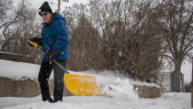
ManitobaSome parts of Manitoba could see more snow than usual this winter, Environment and Climate Change Canada says.Weak La Niña weather pattern likely will lead to higher precipitation in Prairies, agency saysArturo Chang · CBC News · Posted: Dec 11, 2025 4:35 PM EST | Last Updated: 5 hours agoListen to this articleEstimated 3 minutesThe audio version of this article is generated by AI-based technology. Mispronunciations can occur. We are working with our partners to continually review and improve the results.Big chunks of eastern and southern Manitoba have a 40 to 50 per cent chance of seeing higher than normal precipitation this winter, Environment Canada said in its winter forecast. (Chelsea Kemp/CBC)Some parts of Manitoba could see more snow than usual this winter, Environment and Climate Change Canada says.Big chunks of eastern and southern Manitoba have a 40 to 50 per cent chance of getting higher than normal precipitation through the season, the federal agency said in its 2025-26 winter outlook.The three-month, low-confidence forecast is based on a relatively weak La Niña, a weather phenomenon that leads to lower sea temperatures in the central and eastern Pacific.The weather pattern typically sees storms move from the Yukon down across the Rockies and into the Prairies, Environment Canada meteorologist Jennifer Smith said during a presentation Thursday.”Basically, draw a line from Whitehorse to Winnipeg,” she told reporters.”It’s a very common path. It’s not going to mean that every storm is going to pass that way, but it does show an increase in that route. So I would definitely plan for a snowier winter.”Environment Canada says there is a higher likelihood regions west of the Great Lakes will see higher precipitation this winter. (Environment and Climate Change Canada)The La Niña pattern also typically leads to colder temperatures in the Prairies, but the agency does not have enough confidence to predict that for the region, Smith said. However, Canada is “certainly seeing that classic La Niña signature” to start the winter, and the region will likely continue to see Arctic blasts and cold spells interspersed with warm-ups, she said.”Kind of feels like an artifact of [past winters]. It’s not something we’ve seen for a while in parts of Canada,” she said.The Yukon is experiencing low temperatures early in the season this year, something that hasn’t happened since the early ’90s, Smith said.”Some of that cold air will be working its way into the Prairies over the next couple of days.”But some parts of northern Manitoba are highly likely to actually see above-average temperatures as the Arctic continues to warm.Temperatures this winter will be warmer than normal across the eastern Arctic, Environment Canada says. (Environment and Climate Change Canada)Communities around Hudson Bay are 40 to 70 per cent more likely to see even warmer temperatures after an already warm winter last year, Environment Canada said.The agency said Canada is warming at nearly double the speed of the global average, and it’s even faster in the north. The changing climate is leading to warmer-than-usual sea surface temperatures in the Bay, the agency said.Precipitation rates are increasing generally across Canada, with amounts varying widely across the country, Environment Canada said. A newly expanded extreme event attribution system says two major weather events in northern Manitoba this year — a winter storm in October and some heavy rainfall this summer — were made more likely because of human-caused climate change.
Manitobans should gear up for what may be a snowier winter, Environment Canada says


