

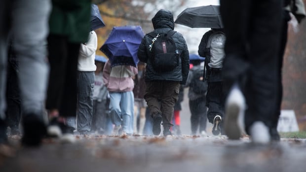
British ColumbiaWinds gusting up to 110 km/h and up to 140 millimetres of rain is expected in some areas of B.C. on Thursday and Friday.Flood watch issued for north, central coast, and northern Vancouver IslandCBC News · Posted: Oct 23, 2025 4:10 PM EDT | Last Updated: October 23Listen to this articleEstimated 3 minutesHeavy rain is expected for a large portion of B.C. by Friday, including Metro Vancouver, Vancouver Island and much of the coast. (Ben Nelms/CBC)Wind and rainfall warnings have been issued for a large portion of British Columbia on Thursday, as Environment Canada is forecasting 110 km/h gusts and 140 millimetres of rain throughout the day in some areas.On Wednesday, the forecaster had issued warnings for the north and central coast — but by Thursday, the warnings were expanded to include the south coast, Vancouver Island and a good portion of the central and southern Interior. Environment Canada says a “vigorous” frontal system is moving southeast down B.C.’s coast, which means heavy rain, particularly in Portland Inlet and Milbanke Sound along the north coast, where 100 millimetres is forecast to fall by Thursday evening. Inland sections of the north and central coast are looking at about 50 millimetres of precipitation in that time, possibly up to 80.”Heavy downpours can cause flash floods and water pooling on roads,” Environment Canada’s warning reads.On Vancouver Island, up to 140 millimetres of rain could fall near Gold River and Zeballos, according to the weather agency. Up to 70 millimetres of rain is expected in Howe Sound, and and on eastern Vancouver Island near Bowser and Courtenay, by Friday morning.The area in red shows how much of B.C. is under rain and wind warnings on Oct. 23. (Environment Canada)Exposed coastal areas on northern Vancouver Island and along the central coast could see winds gusting up to 110 km/h on Wednesday, according to Environment Canada.Strong gusts of up to 90 km/h are expected on the south coast, in Prince George, the Fraser Canyon and the Cariboo, Chilcotin and Stuart-Nechako regions. A special weather statement for Metro Vancouver warns of heavy rain and wind by Friday morning. (Ben Nelms/CBC)”Loose objects may be tossed by the wind and cause injury or damage. High winds may result in power outages and fallen tree branches,” forecasters say in the wind warning.A special weather statement has been issued for Metro Vancouver due to moderate rain and strong winds expected overnight and into Friday, Environment Canada says.Flood watch issued for north, central coast, north Vancouver IslandOn Wednesday afternoon, B.C.’s River Forecast Centre issued a flood watch for the north and central coast, as well as northern Vancouver Island, due to the storm. The centre also issued a high streamflow advisory for the south coast and the rest of Vancouver Island. The areas in dark orange on this map are under a flood watch as of Oct. 23, while the areas in yellow are under a high streamflow advisory. (River Forecast Centre)”Rivers are expected to rise rapidly on Thursday and into Friday in response to heavy rainfall,” the warning reads. “Stay clear of the banks of swift running rivers and never drive across flooded roads, bridges or river crossings.”A flood watch means that river levels are rising and flooding in areas adjacent to rivers may occur, while a high streamflow advisory means that minor flooding in low-lying areas is possible.Earlier this week, the province urged British Columbians to prepare for storm season by clearing storm drains to reduce localized flooding, and having emergency kits ready to go in the event of a power outage or flood.
Rain, wind warnings issued for much of B.C. as up to 140 mm forecast


