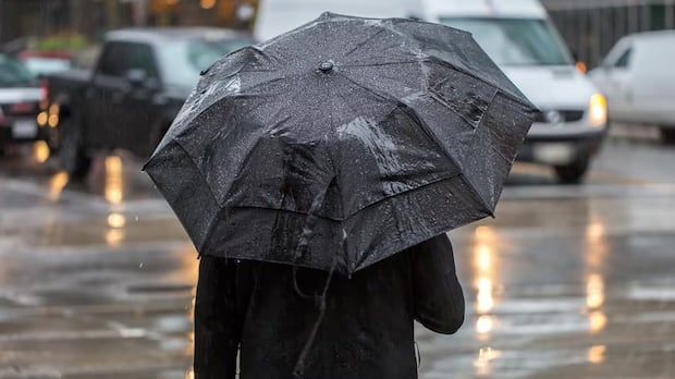
ManitobaParts of southern Manitoba are in for a big soaking on Monday.Some areas could get more than of 50-60 mm, Environment Canada saysCBC News · Posted: Oct 27, 2025 10:52 AM EDT | Last Updated: 11 hours agoListen to this articleEstimated 2 minutesEnvironment Canada says a persistent rain system could dump as much as 60 mm in some areas before it tapers off on Tuesday morning. (David Donnelly/CBC)Parts of southern Manitoba are in for a big soaking on Monday.Environment Canada issued a special weather statement as a band of slow-moving rain stretches across the region from the Interlake to the U.S. border.The system is expected to shift east slightly through the day, then stall out and linger over the region until tapering off early Tuesday.Precipitation rates will vary, but bands of moderate to heavy rain are likely to develop, the weather statement says. That, combined with the slow movement of the system, will result in a lot of rainfall over much of southern Manitoba.Environment Canada said in an update shortly after 3 p.m. CT that between 10 and 20 millimetres of rain has fallen across the western Red River Valley so far on Monday. Another 10 to 20 millimetres is expected on Monday night before tapering off through Tuesday.The highest accumulations are expected over the western Red River Valley and southern Interlake, with 30-50 millimetres likely by Tuesday morning. Some areas, however, could see upwards of 60 mm.Winnipeg isn’t part of the special weather statement but is still going to get 15-25 mm of rain, Environment Canada forecasted.Amounts over the central Red River Valley are likely to be from 30-40 mm and then diminish toward the Ontario border, where 10-25 mm is expected.More news from CBC Manitoba:
Sunday, 22 Mar 2026
Canada – The Illusion
Search
Have an existing account?
Sign In
© 2022 Foxiz News Network. Ruby Design Company. All Rights Reserved.
You May also Like
- More News:
- history
- Standing Bear Network
- John Gonzalez
- ᐊᔭᐦᑊ ayahp — It happened
- Creation
- Beneath the Water
- Olympic gold medal
- Jim Thorpe
- type O blood
- the bringer of life
- Raven
- Wás’agi
- NoiseCat
- 'Sugarcane'
- The rivers still sing
- ᑲᓂᐸᐏᐟ ᒪᐢᑿ
- ᐅᑳᐤ okâw — We remember
- ᐊᓂᓈᐯᐃᐧᐣ aninâpêwin — Truth
- This is what it means to be human.
- Nokoma


