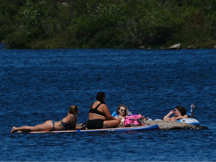
Paddleboarders and tubers try to beat the heat in Dartmouth’s Albro Lake on Tuesday. Photo by Tim Krochak /Chronicle HeraldArticle contentNo one in Nova Scotia pays closer attention to the weather than Cindy Day and she’s surprised an official heat warning hasn’t already been issued for the province.THIS CONTENT IS RESERVED FOR SUBSCRIBERS ONLY.Subscribe now to access this story and more:Unlimited access to the website and appExclusive access to premium content, newsletters and podcastsFull access to the e-Edition app, an electronic replica of the print edition that you can share, download and comment onEnjoy insights and behind-the-scenes analysis from our award-winning journalistsSupport local journalists and the next generation of journalistsSUBSCRIBE TO UNLOCK MORE ARTICLES.Subscribe or sign in to your account to continue your reading experience.Unlimited access to the website and appExclusive access to premium content, newsletters and podcastsFull access to the e-Edition app, an electronic replica of the print edition that you can share, download and comment onEnjoy insights and behind-the-scenes analysis from our award-winning journalistsSupport local journalists and the next generation of journalistsRegister to unlock more articles.Create an account or sign in to continue your reading experience.Access additional stories every monthShare your thoughts and join the conversation in our commenting communityGet email updates from your favourite authorsSign In or Create an AccountorArticle contentThe longtime meteorologist said on Monday a stretch of extremely hot weather is about to hit and people would be wise to prepare.Article contentArticle content“I would imagine very soon Environment Canada will issue that warning,” she said. “It’s going to be very warm and very muggy, but the overnight temperatures are also not going to cool down very much, and that’s the criteria that is necessary (for an advisory) — the warm days, high humidity, and warm nights as well. We’re going to be in that through the entire week.”Article contentArticle contentTemperatures will exceed 30 degrees Celsius in most places in Nova Scotia for the next several days, but Day said it’s the listed ‘feels like’ numbers people should really monitor. Current forecasts call for those highs to hover around 37 degrees at peak periods every day in several locations across the province.Article content“I would say that is the more important number to focus on because that’s what your skin and your body has to deal with,” Day said. “So if you’re outside and you’re going for a little walk and you sweat a little bit, that moisture on your skin can’t evaporate into the air because the air is already very humid. So your body perceives it as being 38, 39 or 40.Article content“So the temperature on the thermometer is a nice number and it’s really the one that we have to focus on if we’re giving somebody a forecast. But it’s a ventilated temperature in a white Stevenson screen (meteorological instrument) with air blowing through it. It’s not really what you feel if you’re walking on a hot day in the warm air in the sun. That’s really the number we should focus on — that humidex value.”Article contentArticle content A surfer runs towards the waves as he and dozens of others cool off at Lawrencetown Beach in this file photo. Photo by Tim Krochak /Chronicle HeraldArticle contentDiving a bit deeper into the meteorology of it all, Day said there are a few other variables, such as occasional rain and wind direction, that she expects will intensify the heat’s effects in the coming days.Article content“Oftentimes when we have these warm, muggy days, the wind is southeasterly, and that offers a lot of cooling for coastal areas,” she said. “But the way the compression is on the backside of the Bermuda high, it’s not coming off the water as much. It’s more of a southwesterly circulation, so the compression and the heat is not going to bring much relief to coastal areas.Article content“It’s going to be, of course, a little cooler right along the water’s edge, but we’re not going to get those nice onshore winds that develop late in the day that bring that temperature down and that allow for better cooling at night and better sleep. So I think that’s going to make the risk a little higher with this building heat and humidity for the next several days.”Article content“And for those areas that got the heavier downpours anywhere, the water sat for a little bit, so when the sun comes up and there’s not much wind, that evaporation fills the lower levels of the atmosphere with more moisture, even though it’s a nice sunny day,” she added. “There’s that low-level humidity coming off the grass and the fields and the land from that added moisture from those heavy downpours.”
Extended heat wave about to hit Nova Scotia